










The Tropics are heating up, just two weeks into the Atlantic hurricane season.
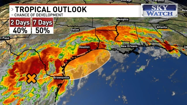
An area of low pressure over northeastern Mexico has the potential to become the first named storm of 2026: Arthur.
Right now, it’s just an area of disorganized showers and thunderstorms.
But as that trough of low pressure moves offshore and into the northwestern Gulf of Mexico, there is about a 40% chance for tropical development over the next 2 days, and a 50% chance within the week.
The storm is expected to bring very heavy rain and flooding to much of the Gulf Coast, with up to 10 inches possible in parts of Louisiana and Texas, including the Houston metro area.
As the system tracks northeastward, Friday, June 19, could bring some much-needed rain to both western North Carolina and the Upstate.
The highest rainfall potential over the next seven days is in the far western mountains, with up to 3 inches of rain possible.
The rainfall potential decreases heading east, with the French Broad River Valley possibly seeing up to 1.5 inches of rain and the Foothills up to 0.75 inches.
STORY & PICTURE COURTESY OF WLOS-TV13
